If you use Adobe Lightroom Classic, you know there is a module called “Map” that allows you to include the locations of your photographs.As a lifelong map enthusiast, with an adult-onset photography hobby, I love the Map module. I love it enough that I have spent far too much money on Nikon’s GP-1 GPS receiver1 so I can keep relatively precise locations of each image.
Roughly half my images over the last 20 years have GPS data, with the most recent images having the most consistent coverage.
Filling In The Map
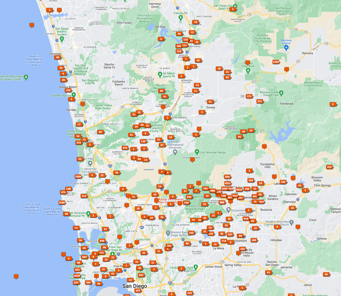
One of the challenges has been to capture photographs and fill the map. In this case, my focus is in San Diego County. I have a lot of friends who love to hike and take photographs, so I thought presenting current Maps from my Lightroom Catalog would be useful. I can show areas that I have visited, areas I need to visit, and perhaps some of you will want to get out on the road or the trail and help me fill these maps in.
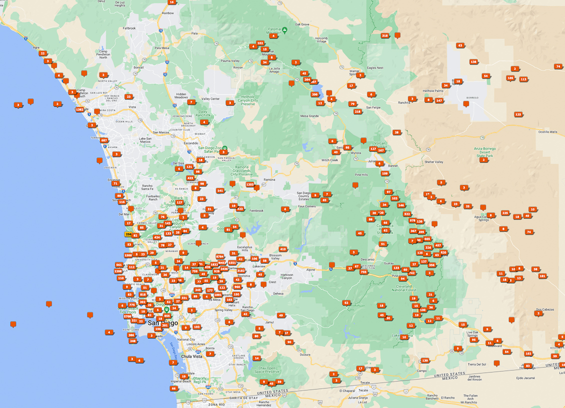
To see my map as recently as a couple weeks ago, here is the first image, comprised of the majority of San Diego County. You can see where I have GPS images at, and where I have holes to fill in. For those wondering, several of those images out in the Pacific Ocean are accurate, as I have been known to take a few out the airplane window2.
Just looking below, it is easy some good spots that I have missed and would be up for a good visit.
San Diego County Lightroom Map
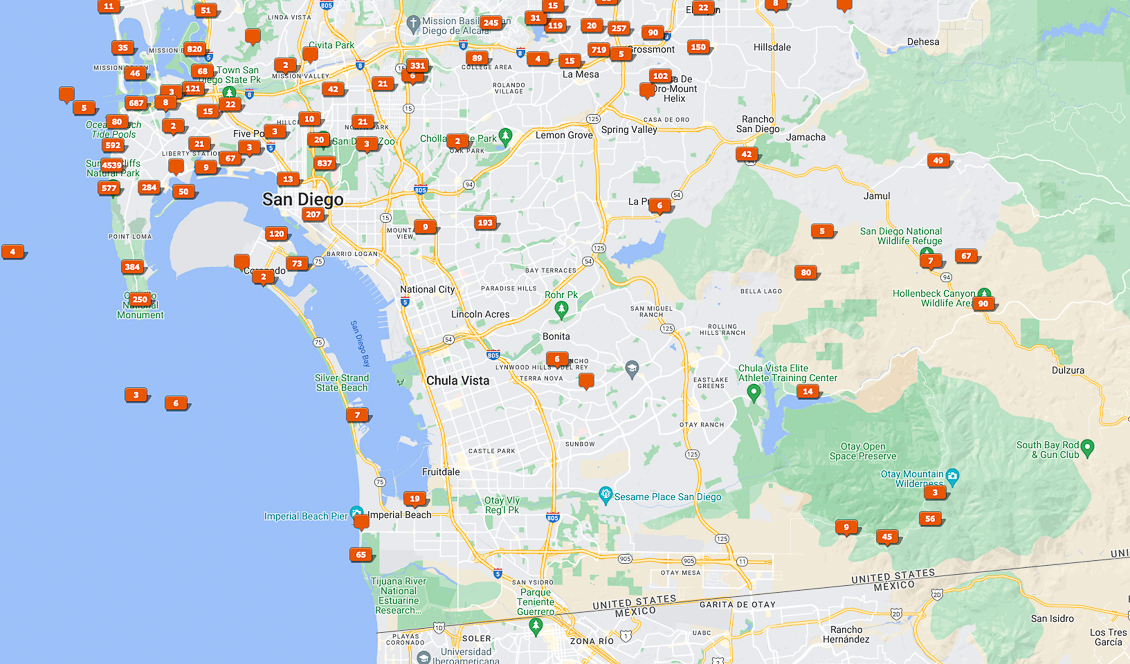
San Diego and South Bay
This map needs a lot of work. Not just the urban photos, but a lot of places in South and East County that need some time and attention. I only did Otay Mountain once with my friend James. I actually filled in some of Steele Canyon today to Sweetwater Reservoir with friends Nick and Gary, but I am tired enough that I didn’t feel like making a new screenshot.
Southern-East County
For as much time as I have spent in East County, and my love for Old Highway 80, I am a bit surprised that I don’t have too much here. Some areas of the 94 corridor are hard to find parking. I haven’t done any of Carrizo Gorge, for the simple reason that it is technically private property. I am not into trespassing. I do have a photograph of the Goat Canyon Trestle, but only from the confines of a Southwest Airlines flight overhead. I have long wanted to do more of the trails of Pine Valley Creek. Lots to do in this map.
San Diego City – Central and North
It shouldn’t be a surprise that I cover a lot of places in the main part of San Diego and the suburbs. But many misses here, including in the Rancho Santa Fee and Elfin Forest areas. Some areas East need to be explored. Not enough stops on Highway 78. And some big misses along the coast, which I admit are places I shy away from, assuming there is no parking. I would like to fill this in some more.
East County – Central
I have a decent job here, because I think the Sunrise Highway-Cuyamaca-Descanso corridors is one of the best drives in the State of California. It is easy to see that I have spent a lot of time along Sunrise Highway and the associated overlooks and trailheads. I see I have a very big hole along the PCT, which I have hiked before but may not have had my GPS module at the time. Cuyamaca Rancho State Park has a lot of trailheads that I have only casually explored. There are a lot of opportunities South as well, along the Alpine and Japatul Valley corridors.
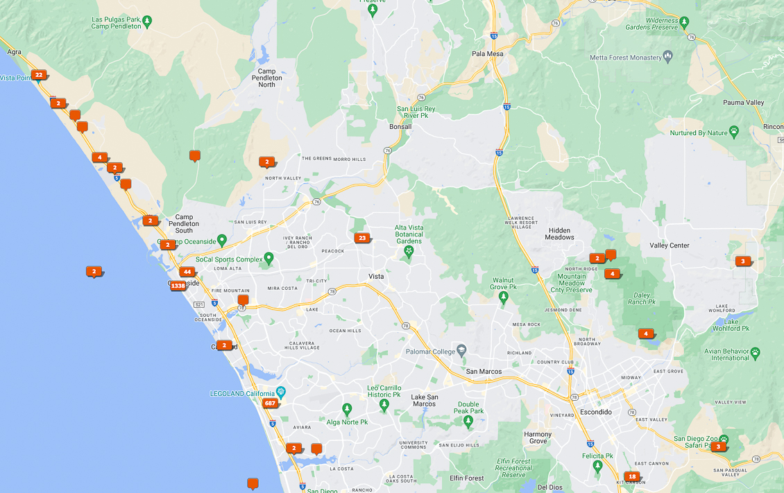
North County – Coast and Central
Not much going on here. This is far too empty. Who wants to help me add some waypoints here?
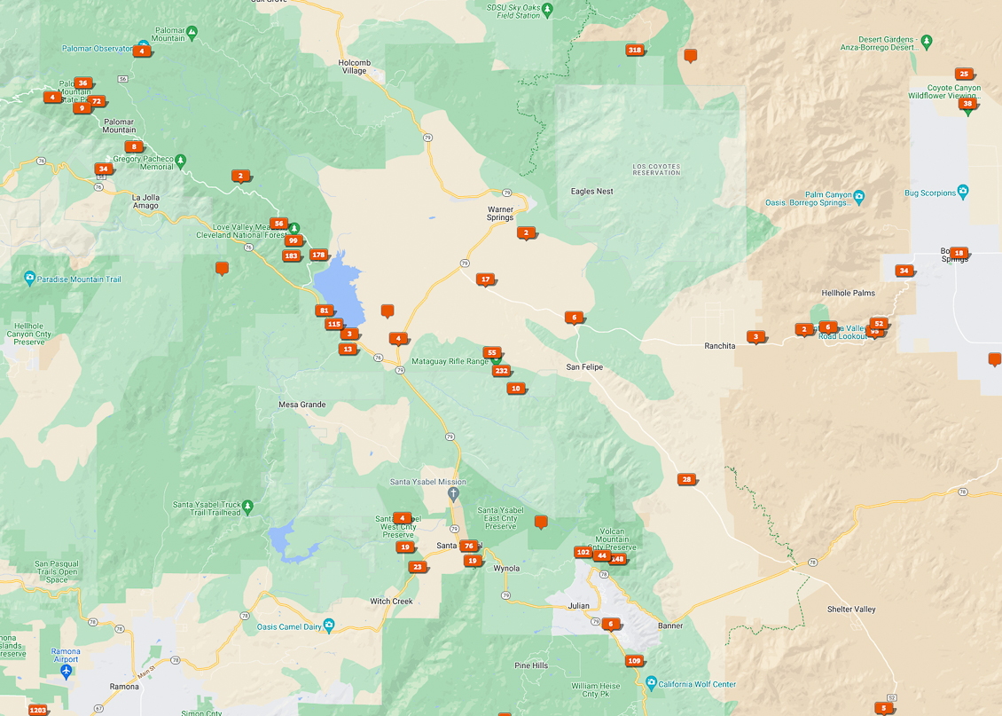
Warner Springs and Borrego Springs
Some of this area suffers from areas that I don’t have GPS waypoints for, but I can see a number of areas to fill in. Hot Springs Mountain on the Los Coyotes Reservation is the actual high point of the County, and has a nominal fee to use the road/trail to the top. I’ve always wanted better imagery in the Mesa Grande area, but there are very few turnoffs. I do need to hike the PCT section North of Shelter Valley, which I haven’t done.
Anza Borrego
Anza-Borrego Desert State Park needs a lifetime to see every spot, but I also have so many areas to see. Who wants in, and….do you have 4-wheel drive?

Further Viewing
Greater San Diego Portfolio Gallery
Anza-Borrego Desert State Park Portfolio Gallery
T.M. Schultze Fine Art America Print-On-Demand Store
T.M. Schultze is a San Diego-based photographer, traveller, and writer. He writes, photographs, and draws things of the outdoors that have inspired humans for thousands of years. He co-authored the Photographer’s Guide to Joshua Tree Park which can be purchased here.



I love Lightroom’s Map module, and the GPS feature in my Canon 5D Mk IV makes using the module Lightroom so easy. It may be crazy, but the lack of built-in GPS in many cameras today is one of the many reasons why I keep putting off upgrading.
Agreed. And the Nikon GPS is expensive for what you get.