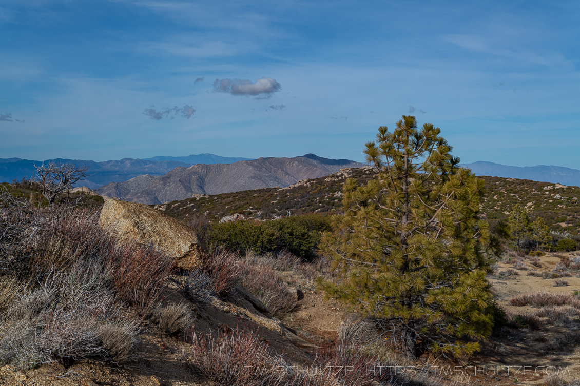
My February 2021 Photo of the Month is LM91, a photo taken in the lower Laguna Mountains as a storm was approaching.
LM91 Background
I always say I am going to stop photographing Granite Mountain, but here we are again, my friends. Although I often feel and I and my friend have exhausted every vantage-point in the Laguna Mountains, I have found some respite there during the pandemic. Not the super busy areas of the Sunset Trail complex or Penny Pines, but other less visited environs.
Along the Northern and lower side of Sunrise Highway, I have always found myself admiring some of the “lone trees.” I have done this before, from this image, for instance. Many people do not realize that North of Kwaaymii Point, this is all part of Anza-Borrego Desert State Park. This section is below 5,000 feet and dominated by chaparral.
This area has a couple lone pine trees that I have long admired. Getting to these parts is tricky though, because there is seldom room for parking. I drove through a couple times, and found a spot of dirt just large enough for my Escape. First part of the quest – complete.
As it turns out, the spot of dirt wasn’t happenstance. Walking down the road edge, I find dessicated asphalt. There used to be a road here. On the North side, the remains of a barbed wire fence are reduced to assorted posts and rust. Along this line, there are more pines. In fact, if I had to guess, many may have been planted on purpose. Even getting away from humans, brings me to humans past.
Road Prospecting
I couldn’t figure out what the “road” was used for. The first guess was mining, and indeed, if you look for it you can see a large gully widened by erosion. But I didn’t find any other tell-tale signs of mining activity, so I can’t say for sure. The 1942 Topo Map of Cuyamaca Peak shows it as a non-named offroad trail partially descending Oriflamme Creek, while a 1960 Topo Map of Monument Peak shows it labelled as simply, “Jeep Trail.” However, the 1997 version should have a couple “Prospect X” markings, which I have read was simply a shallow pit excavated for getting mineral samples. So if they went to the trouble of paving at some point, they must have intended to mine but ultimately didn’t follow through.
The tree I chose wasn’t as isolated as I thought it was from Sunrise Highway. It was actually shouldered by a small rise of rocks, and to the right by the erosive gully that I mentioned. As it turned out, framing the image ended up best with Granite Mountain.
I only had a spare couple minutes to compose. A mass of clouds were coming in quickly, and they were seconds from blocking out the light (See what it looked like). I photographed several angles – this was the one I liked best. LM91 fills in another space along Sunrise Highway that I have long wanted to see closer.
This section of Sunrise Highway needs more study. Since the pandemic has doubled down on my reclusive instincts, I believe I will find myself in this area in the months ahead. Now, if we can just get some clouds to come back.
As always, thank you for reading, and I hope you enjoy the image.
Further Viewing
Photos of the Month Portfolio Gallery
Laguna Mountains Portfolio Gallery
T.M. Schultze Fine Art America Print-On-Demand Store
T.M. Schultze is a San Diego-based photographer, traveller, and writer. He writes, photographs, and draws things of the outdoors that have inspired humans for thousands of years. He co-authored the Photographer’s Guide to Joshua Tree Park which can be purchased here.
