This weekend brought another storm to San Diego (wildflowers should be fantastic next month). In anticipation of picturesque weather in the desert, my friend Alex and I decided to head to Anza Borrego Desert State Park (see his post on the trip).
As usual, below is a gallery of images from the trip. Clicking on any of the images will launch the slideshow. Read below for more information.


Alex suggested we visit a loop he has completed that took us from The Slot parking lot up the West Butte Borrego Mountain (one of the Sierra Club San Diego County 100 Peaks), down a ridge to the lower wash below the Dropoff, over some wind cave formations, and finally up through the Slot and back. All told, this turned out to be about 5.9 miles.
Anza Borrego – Everything Is Green!
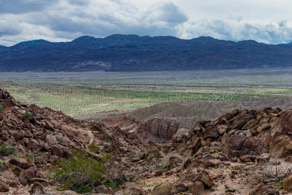
As soon as we descended Highway 78’s Banner Grade and down the San Felipe Wash, it was apparent that the desert had completely transformed over the winter. Drought-hardened plants and barren desert were now vibrant and green.
I wasn’t shooting landscapes much back in the famous 2005 wildflower season, but this certainly looked like as superb as it could get. In particular, the ocotillos really stood out. Each branch was covered with beautiful green leaves, thriving in a superb winter season. Some sprouted a few flowers, but it was a little early. I like to look for Ocotillo flowers because they tend to be the earliest to signal spring has arrived.
On our hike, there were dramatic scenes unfolding to the West as the storm cleared the Laguna Mountains. Beautiful cloud formations could be seen throughout the Borrego Valley. Occasional cloudbursts in the Hellhole and Borrego Palm Canyon areas were apparent from miles away.
Hiking Up West Butte
The West Butte was a relatively easy hike up. There was a rock cairn on top that was assumed to be the peak, but that wasn’t the case. The reason for the cairn placement was not apparent. On top, there were seemingly three different “summits.” It was difficult to tell which one was indeed the top. If anything, there were within a few feet of each other. Just in case, we went to the top of all three, so nobody can say we didn’t actually make the top.
The ridge walk down to the bottom wash was a couple miles of easy hiking, until we reached a difficult talus slope near the bottom. This was not a great area to scale down with a camera around your neck, but I was loathe to put it in my camera bag because with the weather, there seemed to be a great scene at every turn.
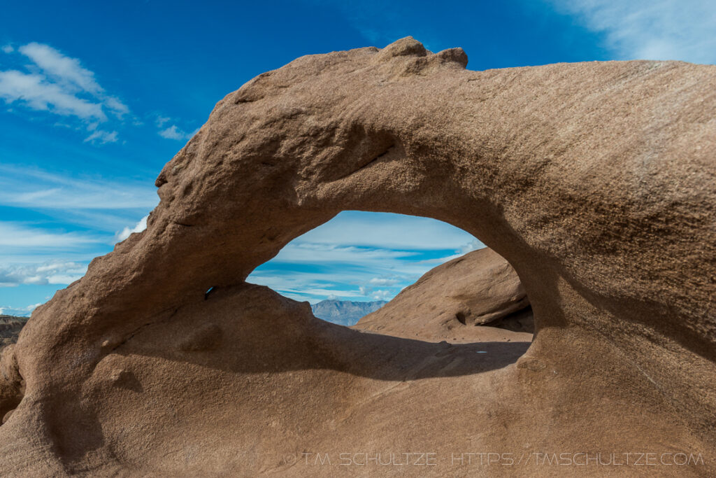
Wind Caves And A New Arch
Alex took me up a scenic route straight up some steep slickrock to a wind cave section. It reminded me of the Hole in the Rock area of Mojave National Preserve. The personal highlight for me was a beautiful arch in the wind cave area. It had a nice opening to Toro Peak in Northern Anza Borrego. The arch is not named, to the the best of our knowledge.
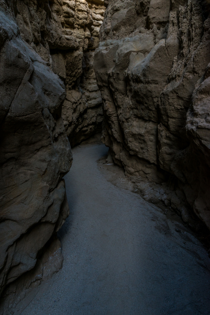
The Slot
On the last leg, we reached The Slot. This is still an area I struggle to make great images. There is one section that is intensely narrow, and there is always a lot of people coming through on weekends. The rock is also a neutral brown, and it doesn’t glow with reflected light (it is definitely not like Antelope Canyon). Some of the slot canyon is also relatively open at the top. This makes it very difficult to keep the sky out of the image, resulting in a need for dynamic range that exceeds what our digital cameras can do.
I am hoping the coming weeks, with more rain on the way, will seal the deal and make this the best wildflower season since 2005. Henderson Canyon and Hellhole Canyon will be extremely busy, but I am hoping to find some other places a little out of the way to enjoy Anza Borrego some more.
As always, thank you for reading, and I hope you enjoy the images.
T.M. Schultze is a San Diego-based photographer, traveller, and writer. He writes, photographs, and draws things of the outdoors that have inspired humans for thousands of years. He co-authored the Photographer’s Guide to Joshua Tree Park which can be purchased here.